 |
The Duncton Guide West Sussex |
click for Rother Valley Trail link |
The Rother Valley
West Sussex, England Duncton Index |
| Vintage trail | local travel | Churches | Headstones | Old English Pubs, Inns & Taverns | emergency services archive | old railways | contact us | more |
 |
The DUNCTON Guide WEST SUSSEX INDEX
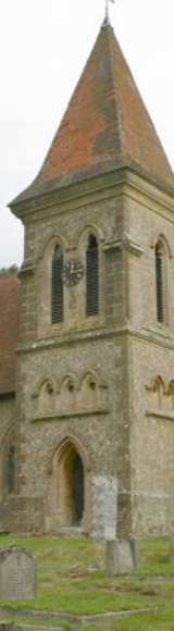
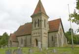
Duncton village and parish is to the south of Petworth at the foot of the South Downs and is on the A285 Chichester road which hairpins out of the village to the summit of the Downs. The parking area near the top of Duncton Hill has panoramic views across the Rother Valley.
|
|

|


| |||||||||||||||||||||||||||||||||||||||||||||||||||||||||||||||||||||||||||||||||||||


|
Gravelroots is a locally operated archive based at Fernhurst on the Sussex, Surrey & Hampshire border.
Information and images are updated throughout this site on a constant daily basis. If you regularly use or have visited these pages previously remember to refresh the pages for any new entries...Refresh page. Please let us know if you are searching for specific information and unable to find it, or you see errors. |
Many of the images shown throughout the website are available as prints or as downloads via email click for more information Our offline archives are extensive, if you are here searching for particular images, let us know. |
Todays photos, observations and news are tomorrows history, be part of it.
You can add photos, documents or information to these pages, or even start a new one.
Simply e-mail your material to us & share it with everyone. Your material can be credited to you.
A very short selection of links to some of the many other pages from Gravelroots
Vintage trail | local travel | Churches | Headstones | Old English Pubs, Inns & Taverns | emergency services archive | old railways | contact us | more
Rother Valley communities
Chithurst - - Cocking - - Didling - - Duncton - - Easebourne - - East Lavington - - Fernhurst - - Fittleworth - - Graffham
Harting - - Heyshott - - Iping - - Lickfold - - Linch - - Lodsworth - - Lurgashall - - Midhurst - - Milland - - Northchapel - - Nyewood
Petworth - - Rogate - - Selham - - South Ambersham - - Stedham - - Sutton - - Tillington - - Trotton - - Upperton

|
Part of the Gravelroots archive
Searching for something specific, use the search box This site is best viewed full screen, F11, in 1024 x 768 or higher |

Why do we show adverts, how is the site funded? - Support us

copyright information
page top
Knowledge talks, Wisdom listens
