 |
| Hazy day view down to Duncton.
Part of the hairpin road layout that brings the A285 to the summit can be seen bottom left. photo:- Phil Dixon - 17 Sep., 2006 - next gallery image - - enlarge |
 |
| A clear view looking north, Blackdown can be seen, top left.
In the foreground is Duncton. Petworth is in the distance about 4 miles away. photo:- Nigel Freeman - 9 August, 2005 - next gallery image |
 |
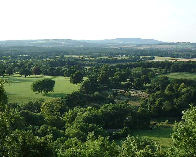
| Looking down on Duncton
photo:- Lyn, Blue Mountains, Australia - 12 Oct.2006 - next gallery image - enlarge |
 |
| Looking down on Duncton
photo:- Lyn, Blue Mountains, Australia - 12 Oct.2006 - next gallery image - enlarge |
 |
| Viewpoint, Duncton Hill
Looking west across the weald and Seaford College. photo:- Phil Dixon - 17 Sep., 2006 - next gallery image - - enlarge |
 |
| Looking over the extensive grounds of Seaford College and beyond from the view point, Duncton Hill photo:- Nigel Freeman - 09 Aug., 2005 |
gallery index - - Rother Valley Trail Link - - next gallery image
you are at Duncton Hill Viewpoint, Duncton, West Sussex - in the Duncton photo galleries, - page viewgall02
Gravelroots is a locally operated website based at Fernhurst on the Sussex, Surrey & Hampshire border. Information and images are updated throughout this site on a constant daily basis. If you came to these pages looking for specific information and were unable to find it, or you see an error, please let us know. |
Todays photos, observations and news are tomorrows history, be part of it.
You can add photos, documents or information to these pages, or start a new one.
Simply e-mail your material to us & share it with everyone. Your material can be credited to you.
A short selection of links to some of the many other sections from Gravelroots
Vintage trail | local travel | Churches | Headstones | Old English Pubs, Inns & Taverns | emergency services archive | old railways | contact us | more
Rother Valley Modern Communities
Chithurst - - Cocking - - Didling - - Duncton - - Easebourne - - East Lavington - - Fernhurst - - Fittleworth - - Graffham
Harting - - Heyshott - - Iping - - Lickfold - - Linch - - Lodsworth - - Lurgashall - - Midhurst - - Milland - - Northchapel
Nyewood - - Petworth - - Rogate - - Selham - - South Ambersham - - Stedham - - Sutton - - Tillington - - Trotton - - Upperton

| This page is part of Gravelroots
Searching for something specific, use the indexes This site is best viewed full screen, F11, in 1024 x 768 or higher |
 |
Why do we show adverts, how is the site funded? - Support us

copyright information
page top
A man who does not read has no advantage
over a man who cannot read
